
old photos of
waterlooville
our favourite historic pictures
We’ve picked out some of the best old photos of Waterlooville. It’s amazing to see how much the town has changed over the years, and fascinating to see some of the more familiar buildings sat in surroundings which now look completely different!
view to the town centre

This one shows the where our office is located! It’s taken from London Road A3, looking north towards Waterlooville town centre. If you still haven’t got your bearings, look for the double decker bus. In present times, the Shell Petrol station would be to it’s right hand side.
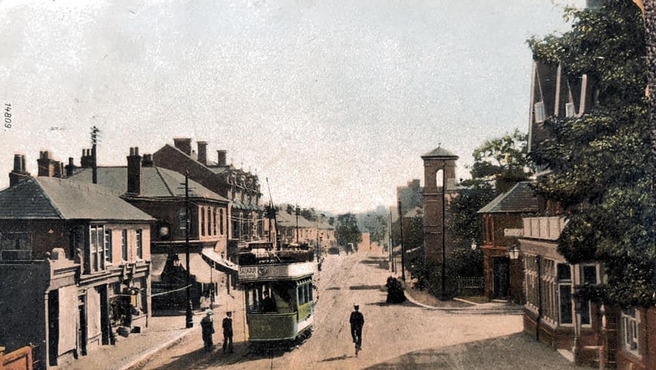
In this photograph you can see the side wall of the Wellington Inn (currently No73 Bar and Kitchen) in the distance on the left hand side of the road, with the two square windows tucked under the gable. The church you see in this photo dates from around 1830. The new church was built in the same plot of land in 1970. The large house on the right hand size of the image is Wait End Farmhouse, which was recently demolished and is now the modern looking nursery building.
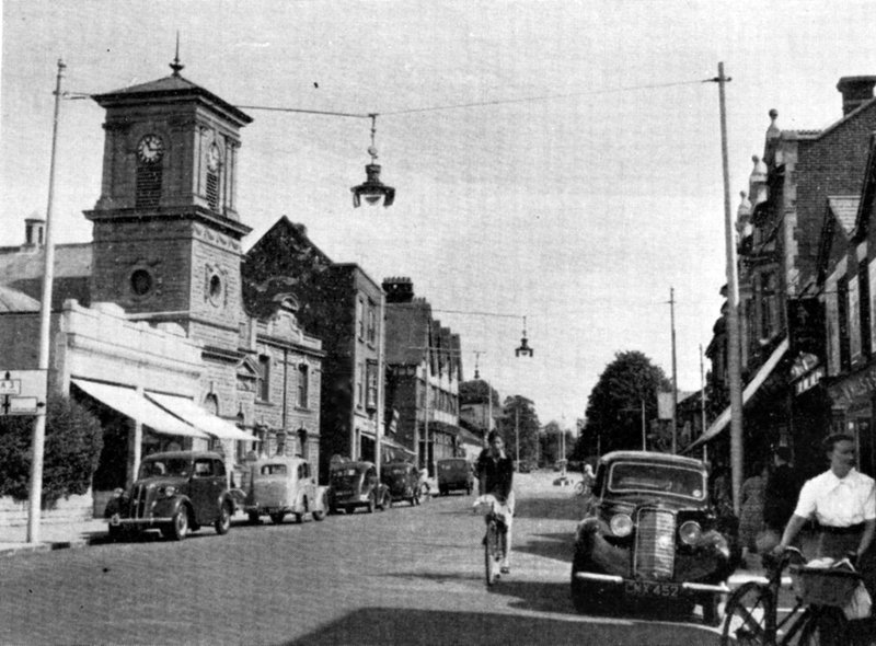
Waterlooville Town Centre
Before the Maurepas Way bypass was built, the A3 used to go straight through the middle of Waterlooville town centre. The tram lines have been removed and tarmac surfacing laid. The overheard power lines are gone and street lighting has been installed. We think this photo was probably taken in the 1940s.
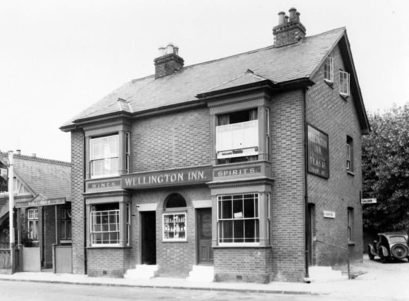
The Wellington Inn
The Wellington Inn still stands to this day. It’s been modernised and extended, but the original building is still instantly recognisable. Permission was granted by the council for it to be demolished and become a residential development, but thankfully the current owners stepped in and saved it.
The pubs name comes from the Duke of Wellington, the victor of the battle of Waterloo in 1815 from which Waterlooville takes it’s name.
You can still visit The Wellington Inn, it’s now called Number 73 Bar and Kitchen. Lovely food which we highly recommend!
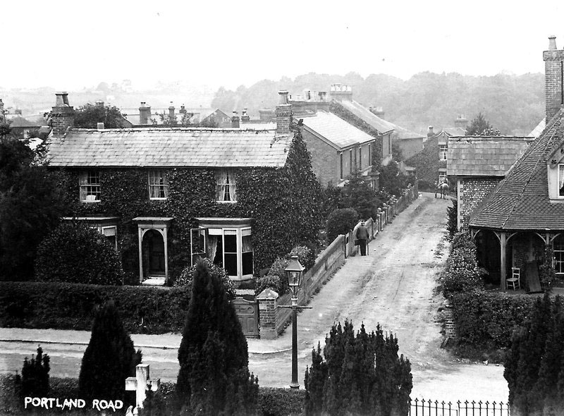
Portland Road Waterlooville
We doubt many people will be able to work out where this photo was taken, but if you’re from Waterlooville you’ll almost certainly know where it is!
The picture is taken from the bell tower of the old Church, looking down Portland Road. At the end of the road, behind where the horse is standing, is now Asda supermarket. The building on the far right hand side of the picture is Swiss cottage. Until recently it still existed and was used as a citizens advice bureau. Unlike the Wellington Pub, sadly it was not saved. It was recently demolished and replaced with ground floor offices and residential flats above.
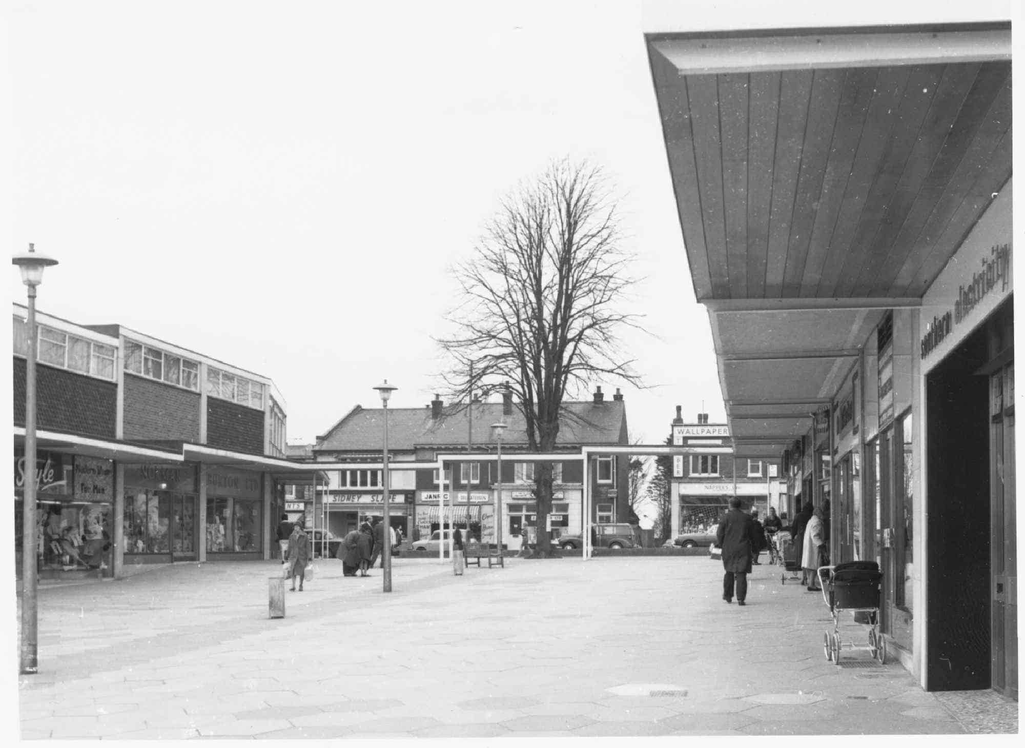
waterlooville Precinct
This photograph shows Waterlooville shopping precinct in around 1970. If you were stood in this spot today, the library would be behind you, and Halifax bank would be straight ahead of you.
looking North from Cowplain
Looking north from Cowplain village centre. If you were stood in this spot today, you would be at the traffic lights with the Co-op on your left hand side. This is a later photo and the tram lines have been removed and modern road markings can be seen. The building visible on the left of the image still exist to this day. At the bottom of the hill on the left is the location of the Spotted Cow pub. The cottages in the distance also survive to the present day.
waterlooville town centre with tram
This photo was taken in Waterlooville town centre, as a tram passes through the crossroads. If you were stood in this spot today, the clock would be in front of you, NatWest on your right and Lloyds Bank on your left. The taller building you can see on left hand side still exists and is now Back To Fitness gym.
Longwood Avenue in Cowplain
One of the older roads in Cowplain is Longwood Avenue. This location is less recognisable than some of the other images we’ve chosen, however it’s interesting because many of the properties still exist, including the two which you can clearly see on the left hand side. At this point in time Brewster Close had not been built, the entrance to which now goes between the house and bungalow in the foreground.
Denmead Village Green
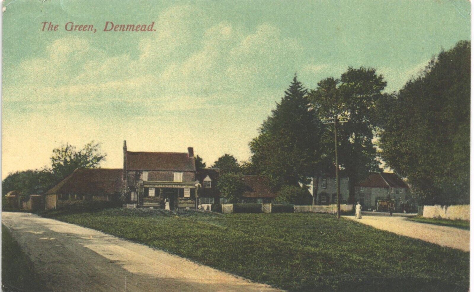
Another location which will be instantly recognisable to local people. Denmead village green, looking towards the present day location of The White Hart Pub. Not much has changed and if you visited this location today it wouldn’t look much different. Most of the buildings in this old photo are still there.
Town Centre Tramway
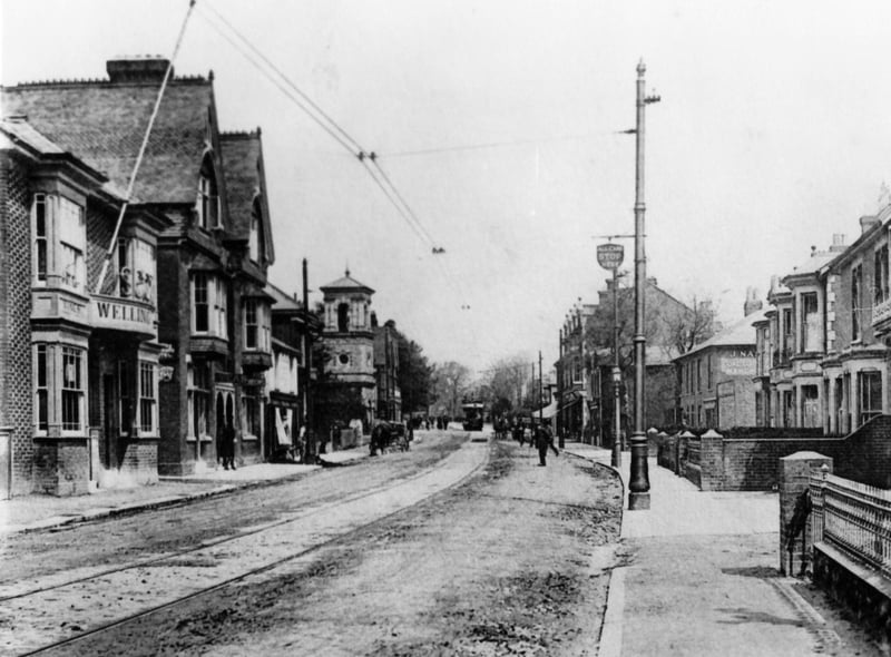
This photo was taken outside the Wellington Pub in Waterlooville town centre, looking north. You can see the tramway in the road and the electric power lines overhead.